Los Menucos: general information See map
The town of Los Menucos is in the southern area of Río Negro, at the intersection of National Route No. 23 and Provincial No. 6, and is one of the most populous cities in the area.
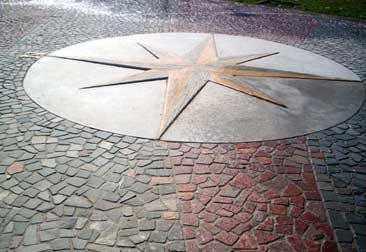 Slabs stone floor.
Los Menucos is in a low place, where north is a system of plateaus and south the terrain begins to rise to the edge of the plateau of Somuncurá being Prahuaniyeu and Comico the main accesses to Somuncura.
Because of this proximity to elevated areas in the city is recorded a profuse mining activity being the most important for its commercial value the kaolin deposits, the extraction of porphyry and slabs stones. In addition, other economic activity that sustains the population is the production of wool and breeding guanacos and rheas sustainably.
Los Menucos owes its name to tehuelche word meaning "eyes of water", this is because "Menucos" are small areas of land that walked on "move" by the effect of being on the presence of water.
Among the water flows more important are the Comicó brook and some important gaps, as the lakes Chanquin and Gaucho Niyeu.
Places to visit
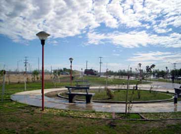 Paseo de la Familia. Los Menucos.
- The removal, cutting and application of slab stones and Porphyry.
- Don Pedro y Los dos Hermanos farms.
- Meseta Infinita
- Los Flamencos, La Arboleda, El Chacay, La Caledonia, slate quarries and artisans cooperatives.
- The lakes circuit.
- Meseta de Somuncurá, Prahuaniyeu and Comicó.
- Guanacos and rheas farms.
- Cave paintings.
In the area around Los Menucos can be perform different activities. These include visits to farms, where you can perform field activities, the recognition of indigenous flora and fauna, hourseback rides, trekking of varying intensity, photo safaris and bike tours.
Directions
Los Menucos is a town of importance of the South Line and the main link to the Upper Valley. It is located 370 km from San Carlos de Bariloche, 500 km from Viedma and 220 km from General Roca. The roads are:
- East: (from Sierra Grande, Pto Madryn, Trelew, Las Grutas) In the Provincial Route No. 23 it takes 264 kilometers to reach Los Menucos.
- West: (from Bariloche, Siete Lagos, Villa Angostura, El Bolsón) Through National Rout No. 23 are about 368 kilometers.
- North: (from General Roca, Upper Valley) Through Provincial Route No. 6 and take the access to the right in the intersection with Provincial Route No. 8.
- Sur: (desde El Caín y Chubut, Gan Gan) Recorrer la Ruta Provincial Nº 8.
Viajes por la Patagonia

Related Articles
© Patagonia.com.ar 2024 | Todos los derechos reservados.