Domuyo: conquering the top of Patagonia See map
In his human nature the man has always had a desire of conquest, of discovery, for better or for worse. Fortunately, Mother Nature got him in the way oceans, mountains and volcanoes. Here we present a new challenge for man: the highest mountain in Patagonia, volcano Domuyo.
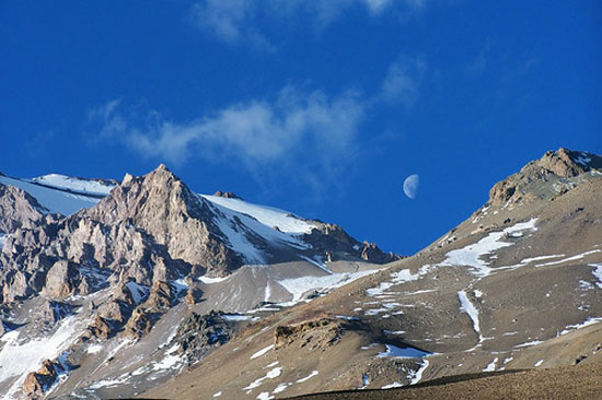 View of the Domuyo.
¿What's Domuyo?
With its 4709 meters of altitude above sea level, the Domuyo is considered the highest mountain in Patagonia. It belongs to a protected area that is in the north of the province of Neuquén, in the Departments Minas and Chos Malal. From the city of Chos Malal, access is through the Provincial Routes 43 and 39.
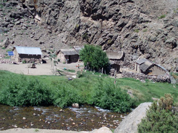 The Atreuco Cajón.
This colossus of land and rock, whose name comes from the Mapuche language meaning "that tremblies and grumbles", is part of the area known as the Cordillera del Viento, which runs parallel to the Andean chain, but in Argentina and lives up to its name by the winds that, every so often, they come to turn and destroy tents in the camps on the way to the summit.
Colonel Manuel J. Olascoaga was the first person to meet the challenge and conquer the summit in February 1882. Over a century later, the mountain equipment has evolved considerably in this activity, existing today a wide range of clothing and technical equipment suitable for mountain, including coping with extreme cold.
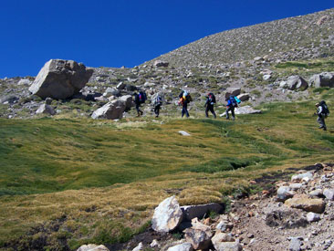 The crossing path to Domuyo.
The climate is temperate in summer and cold-dry in winter, the average annual temperature is around 11 °C, the annual rainfall are of 150 mm and the northwest winds blow more frequently in spring and summer.
Mountaineering is an activity that usually rise together people with an adventurous spirit but that are inexperienced mountaineers.
Anyone can do it as long as have experience in the mountains, otherwise you must be accompanied by an experienced person. You need to have knowledge of mountain and the right equipment.
Experts recommend that anyone who raises the possibility of climbing a mountain should begin as soon as possible with physical training preparing the body for the experience. It is generally advisable to work together with the aerobic endurance in your legs.
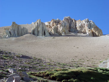 The road is full of surprises and strange formations.
People who can not control their instinct for conquest and want to make the expedition to Domuyo must do the following itinerary:
- It all begins in a village called Varvarco, also known as "Gateway to Domuyo¨. From Chos Malal to Varvarco you pass through spots that seem to reach out to those who visit the area, they are: Alamito, Los Menucos, El Llano, Camalón and Cayanta.
- In this tour you will see streams as: El Manzanito, Cayanta creek and the curious Piedras Meonas, named after their appearance, because it is a huge stone wall from which water flows with surprising intensity, beautiful and interesting place to visit and take pictures.
- Other great places to take pictures are the viewpoints and the route goes by several of them. One of the most striking is Las Puntillas, built with local wood and through a special process which gave it its dark color, this viewpoint offers a tour of singular characteristic as there are more than 100 meters of walkway with handrails on the sides for observing the Cordillera del Viento and Neuquén river from 300 meters high. Many people stop to meet it and from there the photographs allow you to have a more open angle on the landscape that is observed.
- Later and continuing along the same route is Nahueve river, ideal for fishing. By this way the list of streams is not over: El Auque, Las Ramadillas, Atreuco and Covunco.
- In this protected area is known to inhabit mountain lions, red foxes, chinchillas, condors, eagles and more various species of highlands birds. Also in the rushing streams of the protected area inhabited the torrent duck.
 Passing "La montura"
Begins the journey
After seeing beautiful landscapes with different authentic mountain features, ravines, cliffs and even geysers from existing geothermal wells at the site, you reach the area known as El Playón at 44 kilometers from Varvarco.
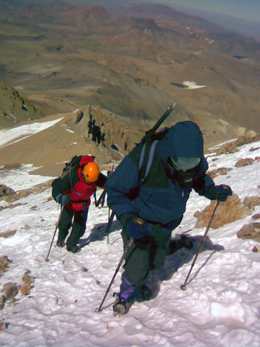
The trek from El Playón to Las Lagunitas at 2,800 (m), the first camp, takes no less than 5 hours. Then you can camp at the 3,800 (meters) before reaching the summit. Slopes of 65 degrees as the one in the area known as ¨La Montura" about 4,100 (m) are part of the road that the trekkers should move on.
Finally you reach the desired peak to enjoy the Patagonian landscape and breathe the pure air of the mountains. On the way back you can make a few kilometers to the town Aguas Calientes where you can enjoy a relaxing thermal bath.
Conquer the Domuyo takes six full days of adrenaline, a reward for effort that has to conquer the highest peak in Patagonia, where few reach but those ones feel something more than conquer the summit.
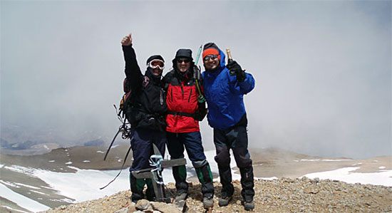 Celebratin at the Domuyo's summit.
For more information visit Patagonia Mountain: http://www.patagoniamountain.com.ar
Viajes por la Patagonia

Related Articles
© Patagonia.com.ar 2025 | Todos los derechos reservados.